El Niño-Southern Oscillation, more commonly called ENSO, refers to a recurring climate pattern response to changing water temperatures in the Pacific Ocean off the coast of Ecuador & Peru.
Why do ocean temperatures in the Tropics impact weather in Wisconsin?
Similar to dropping a pebble in a pond, small regional changes can have larger ripple effects across the globe.
The fluctuation of atmospheric and oceanic circulations over the Pacific impacts the positioning of the jet stream (the highway for weather-systems). As the jet stream shifts around, it impacts temperatures and precipitation patterns across the United States and the world.
It’s Just a Phase
You’re probably most familiar with the different phases of ENSO, called El Niño or La Niña. These phases are on a larger timescale compared to regional weather patterns, lasting for months to even years at a time.
While either phase can develop at any time of the year, the United States feels the most significant impacts from ENSO during the winter months. Some countries, such as Venezuela, the Philippines, and India, feel the effects of ENSO during both winter and summer.
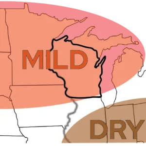
El Niño
Surface winds near the equator become weaker, allowing warmer water to pool along the equator and off the coast of South America. The warmer the water gets, the stronger and more pronounced the impacts become.
Wisconsin Impact
El Niño phases typically cause the polar jet to shift north, locking cold air in Canada. This often leads to a milder winter season in Wisconsin. There’s no strong correlation with precipitation, but warmer temperatures could lead to rain or sleet rather than snow.
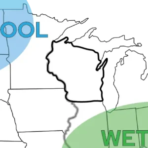
La Niña
Surface winds near the equator become stronger, pushing warm surface water away and allowing cold water to pool along the equator and off the coast of South America. The colder the water gets, the stronger and more pronounced the impacts become.
Wisconsin Impact
In this phase, the jet stream typically shifts south, creating cold weather to our northwest and wet weather to our southeast. La Niña effects typically are less notable in the Badger State, but can create slightly cooler temperatures and slightly wetter conditions.
By the Numbers: ENSO in Wisconsin
Wisconsin’s warmest winter on record (December 2023 to February 2024) and driest winter on record (December 1986 to February 1987) both occurred under the influence of El Niño.
The state’s average temperature during the winter of 2023 to 2024 was 31.8 degrees Fahrenheit — over 12 degrees warmer than average! Northern Wisconsin also suffered a severe snow drought, reporting seasonal totals that were 20 to 60 inches less than normal.
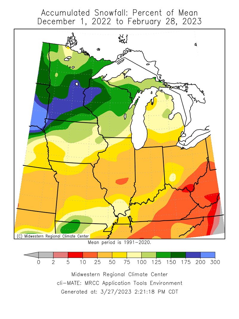
On the other end of the spectrum, Wisconsin’s wettest winter from 2022 to 2023 occurred while a La Niña phase was at play. That winter, some parts of northern Wisconsin received double their normal snowfall, with seasonal totals up to 300 inches!
This is a product of the Wisconsin State Climatology Office. For questions and comments, please contact us by email (stclim@aos.wisc.edu) or phone (608-263-2374).