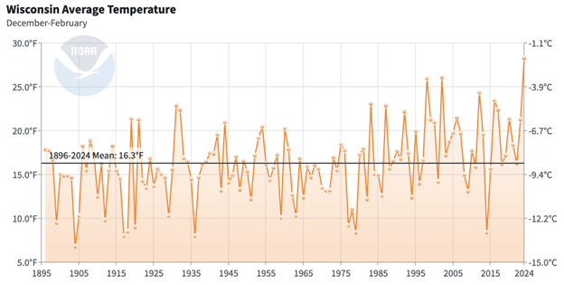
In what was dubbed a “Lost Winter,” warmth extended through the entire winter season, making it the warmest winter (December to February) since record-keeping began in 1895. The statewide average temperature for the winter was 28.3 degrees, surpassing the previous record by a full 2 degrees.
This winter’s record-breaking warmth was likely caused by the one-two punch of an exceptionally strong El Niño and the long-term warming trend, which has been more pronounced in Wisconsin during winter than any other season. El Niños feature unusually high ocean temperatures in the central and eastern tropical Pacific, and they often distort the typical location and strength of atmospheric jet streams in much of the world. Wisconsin often experiences mild winters during strong El Niños, due to a northward displacement of the jet stream that causes Arctic air masses to mostly remain in Canada.
Dry Conditions
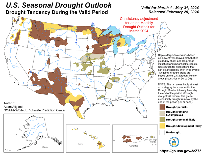
Unfortunately, dryness was a common theme throughout the winter. Although winter is typically Wisconsin’s driest season, much of Wisconsin received even less than its normal liquid-equivalent precipitation, with a statewide average of 3.10 inches. The winterlong precipitation varied substantially by region. Much of southern Wisconsin enjoyed a slightly wetter than normal winter overall, due to a relatively wet January, while most of northern Wisconsin was unusually dry (less than 75 percent of average precipitation). By the end of the winter, 17 percent of Wisconsin was categorized as experiencing severe drought and 65 percent was under moderate drought.
Snow Deficit
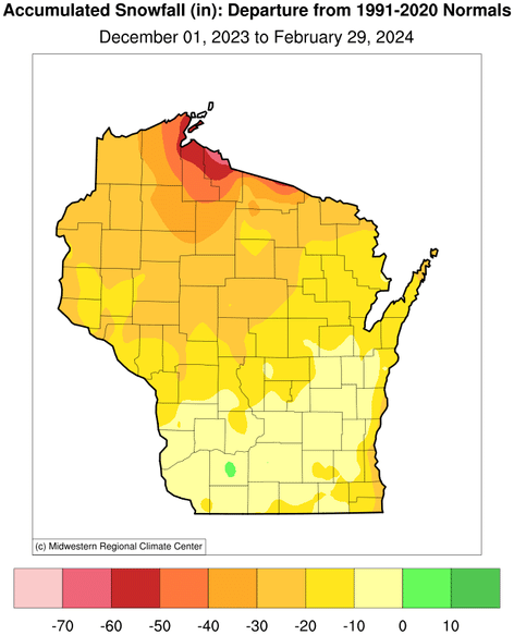
The combination of low precipitation and above freezing temperatures meant a major seasonal snowfall deficit, particularly in northern Wisconsin, where accumulations were 20 to 60 inches below normal. Shortfalls were especially pronounced along the Lake Superior snowbelt, where the near absence of Arctic air masses prevented lake effect snowfall, despite a mostly ice-free lake. Curiously, the southern part of the state was generally snowier than northern Wisconsin, thanks to two significant snowstorms that struck southern and eastern regions in mid-January.
Breaking Records
Aiding the warmth was the unprecedented all-time February and winter high temperature of 77 degrees observed on February 27, 2024 at the Kenosha Airport. Continuing the theme of breaking records, Wisconsin saw its first (and second) winter tornadoes during February. Unseasonably warm, humid, unstable air coupled with sufficient wind shear to create rotation were responsible for these unprecedented February tornadoes.
Consequences of a Warm, Dry Winter
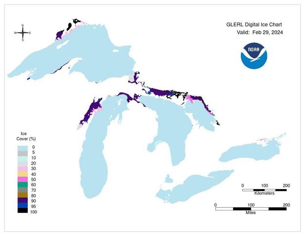
Unfortunately, these mild winter conditions had adverse effects on Wisconsin’s winter tourism industry, with snowmobile trails closed, unsafe ice conditions for fishing, and canceled winter festivals. On Lakes Mendota and Monona in Madison ice cover only lasted about six weeks (January 15 to February 28), which is the second shortest period of ice coverage for Lake Mendota and the all-time shortest for Lake Monona. This meager ice coverage was likely the case for inland lakes statewide. Similarly, ice cover on the Great Lakes was mostly restricted to shorelines and bays at the end of February, even though the ice pack typically reaches its peak extent in late February or early March.
The unseasonably warm weather triggered early maple tree tapping, affecting syrup production schedules. Additionally, early bud break in trees, tree fruits, grape vines, and flowers was observed across the state. Given how quickly weather patterns can change in the Midwest, the possibility of a false spring this year poses a major threat to certain plants. Although it is tempting to assume that a mild winter will be followed by a warm spring, our recent analysis of weather stations around Wisconsin reveals that no significant relationship exists between average winter temperature and the timing of the final hard freeze of the cold season.
Read the full winter 2024 climate summary
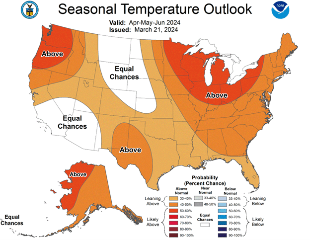
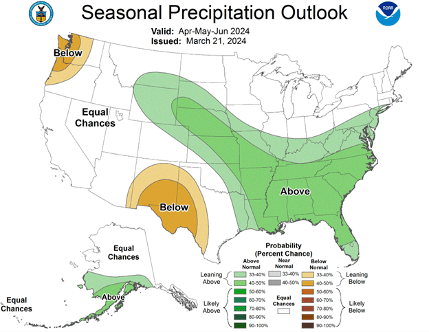
Outlook