As the remaining autumn leaves fall from the trees, November is often the beginning of the brown and dreary season in Wisconsin. The shortened days become more apparent, cloud cover increases, and a real chill begins to settle over the region.
Temperature
The Outlook: Leaning Mild
Wisconsin has been warm in recent months, and the outlook for November suggests that we could expect more of the same. NOAA’s Climate Prediction Center is forecasting a chance of warmer-than-average temperatures across Wisconsin during November. In fact, much of the country could see extra warmth this month.
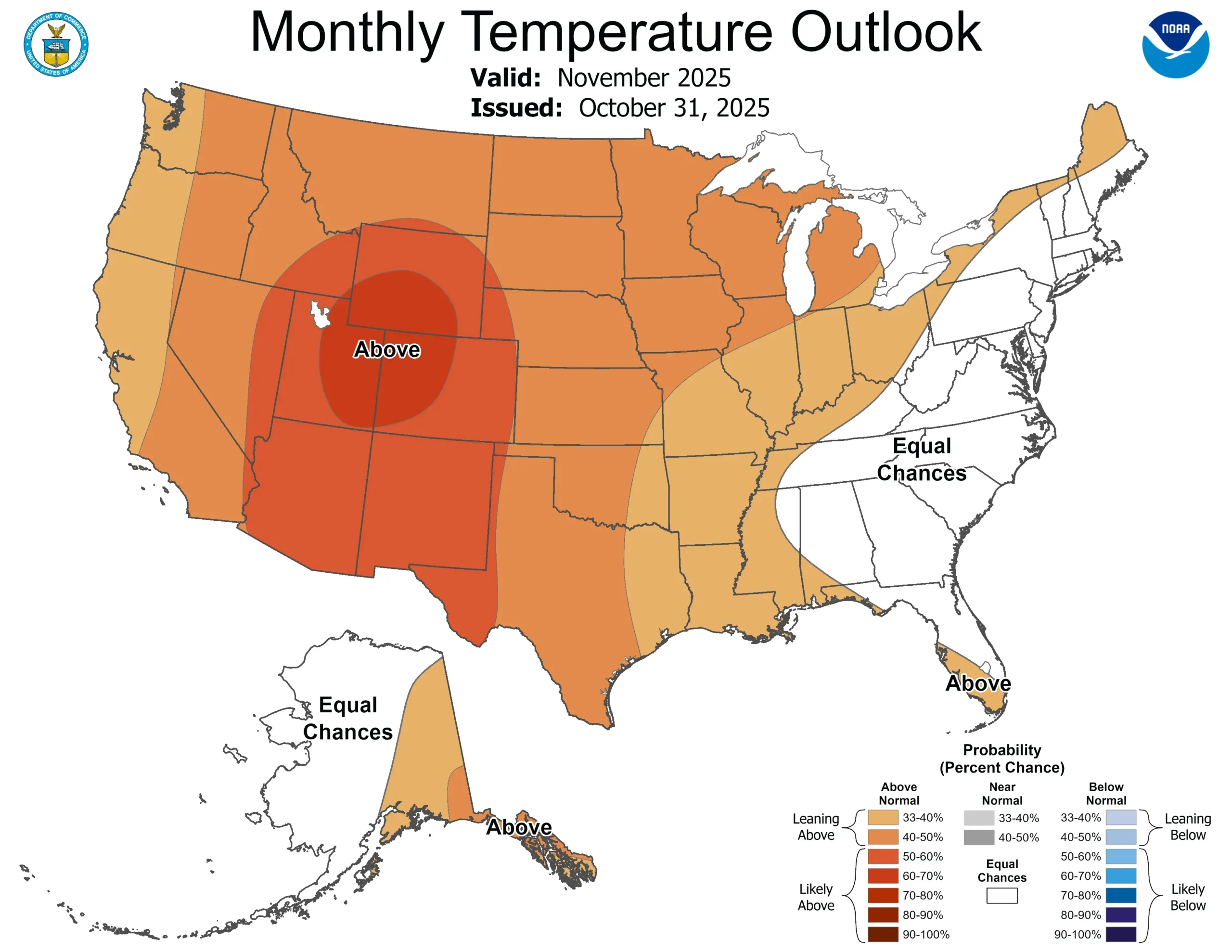
Note that the colors of the above map indicate the probability of above or below average temperatures, not the intensity of the expected warmth or cold. In this case, Wisconsin has a 40 to 50 percent chance of above-average temperatures in November. Check out this blog for more information on deciphering climate probabilities.
The Averages:
Wisconsin’s average temperature for November is just barely above freezing, at 33.4 degrees Fahrenheit. As temperatures get colder through the month, the waters of some smaller lakes often freeze over, including Madison’s Lake Wingra.
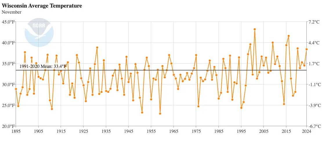
The coldest November on record in Wisconsin was in 1959, when the statewide average temperature was just 23 degrees! Locations in northwest and west central Wisconsin reported sub-zero temperatures as cold as 11 below! The Madison area even dropped to one below on November 17, 1959 — the capital city’s earliest sub-zero temperature on record.
You may recall the warmest November in 2001, when 70-degree temperatures stuck around through the middle of the month! The state’s average high temperature for that month was a balmy 52.7 degrees.
Precipitation
The Outlook: To Be Determined
The Climate Prediction Center does not see any significant signal in the precipitation outlook for Wisconsin this month, giving the state equal chances of experiencing above, below, or near average precipitation.
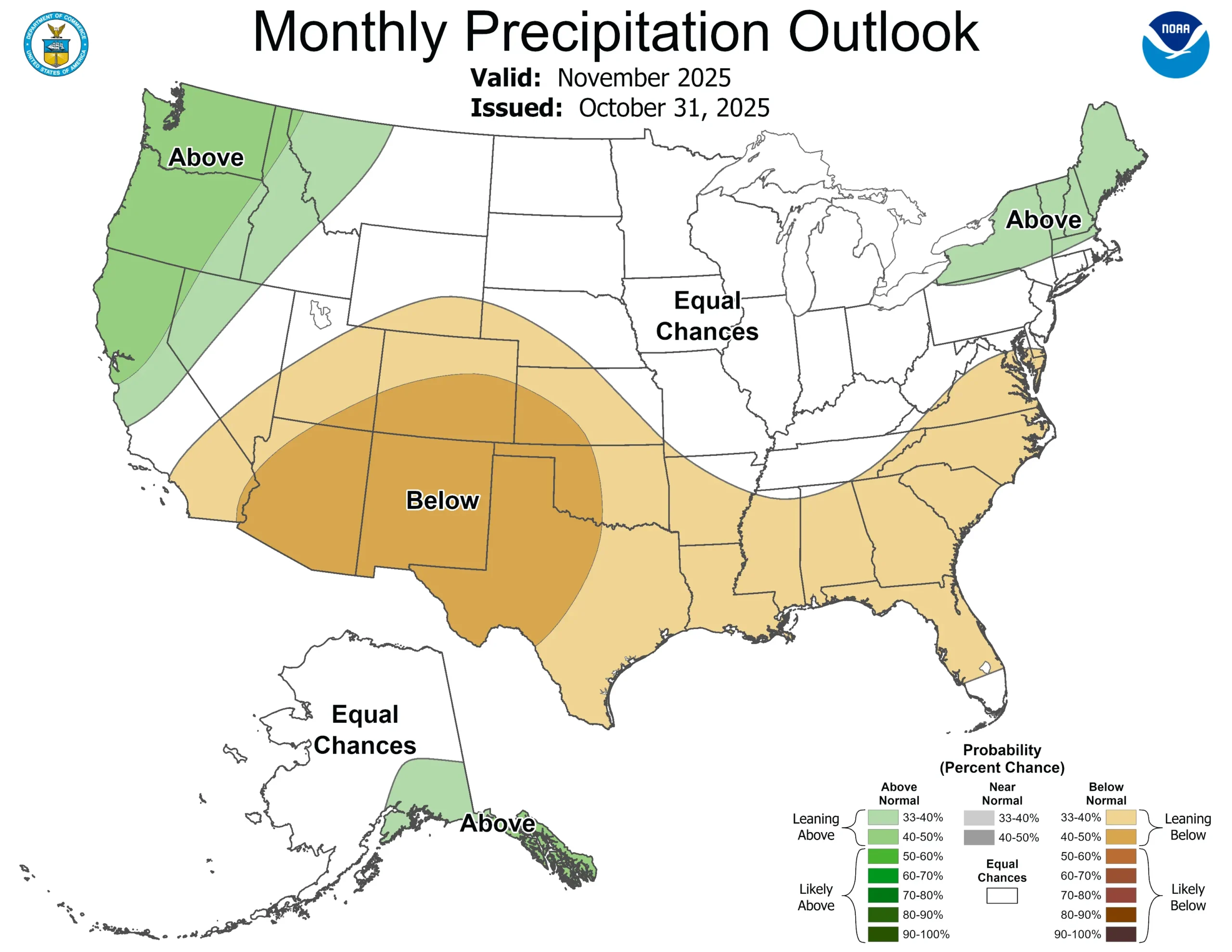
Only the far western and eastern regions of the country are highlighted as having a chance of wetter than average conditions this month, and while drier conditions are possible for the southern US.
The Averages:
Frozen precipitation (snow and sleet) becomes more and more likely as the November days go on. The National Centers for Environmental Information does not track snowfall, but rather the liquid equivalent of precipitation. For example, if two inches of snow fell into a jar and melted, the amount of liquid in the jar is what would be reported.
November in Wisconsin is typically significantly drier than October, averaging under two inches of precipitation across the state.
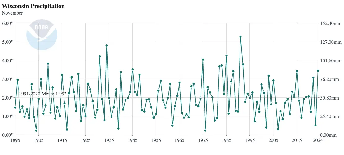
Wisconsin’s wettest November was in 1991, and that’s largely thanks to snowstorms bookending the month.
The Halloween Blizzard started the month, and while the snowstorm had a larger impact on Minnesota, the edge of the storm still managed to dump more than 20 inches of snow in parts of northwest Wisconsin!
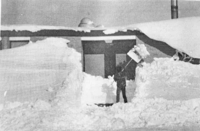
A snowstorm at the end of the month dropped an additional 12 plus inches in the western region. By November 30, the city of Hurley in Iron County had received nearly 60 inches of snow!
The Novembers of 1904 and 1976 were Wisconsin’s driest, with an average of only 0.23 inches of precipitation in the state. During November 1976, La Crosse didn’t report any measurable precipitation, and Wausau only recorded 0.2 inches.
This is a product of the Wisconsin State Climatology Office. For questions and comments, please contact us by email (stclim@aos.wisc.edu) or phone (608-263-2374).