Though not located in the traditional “Tornado Alley” of the United States, Wisconsin gets its fair share of severe storms. Between 1955 and 2024, nearly 23,000 severe weather events occurred in the state, according to NOAA’s Storm Prediction Center.
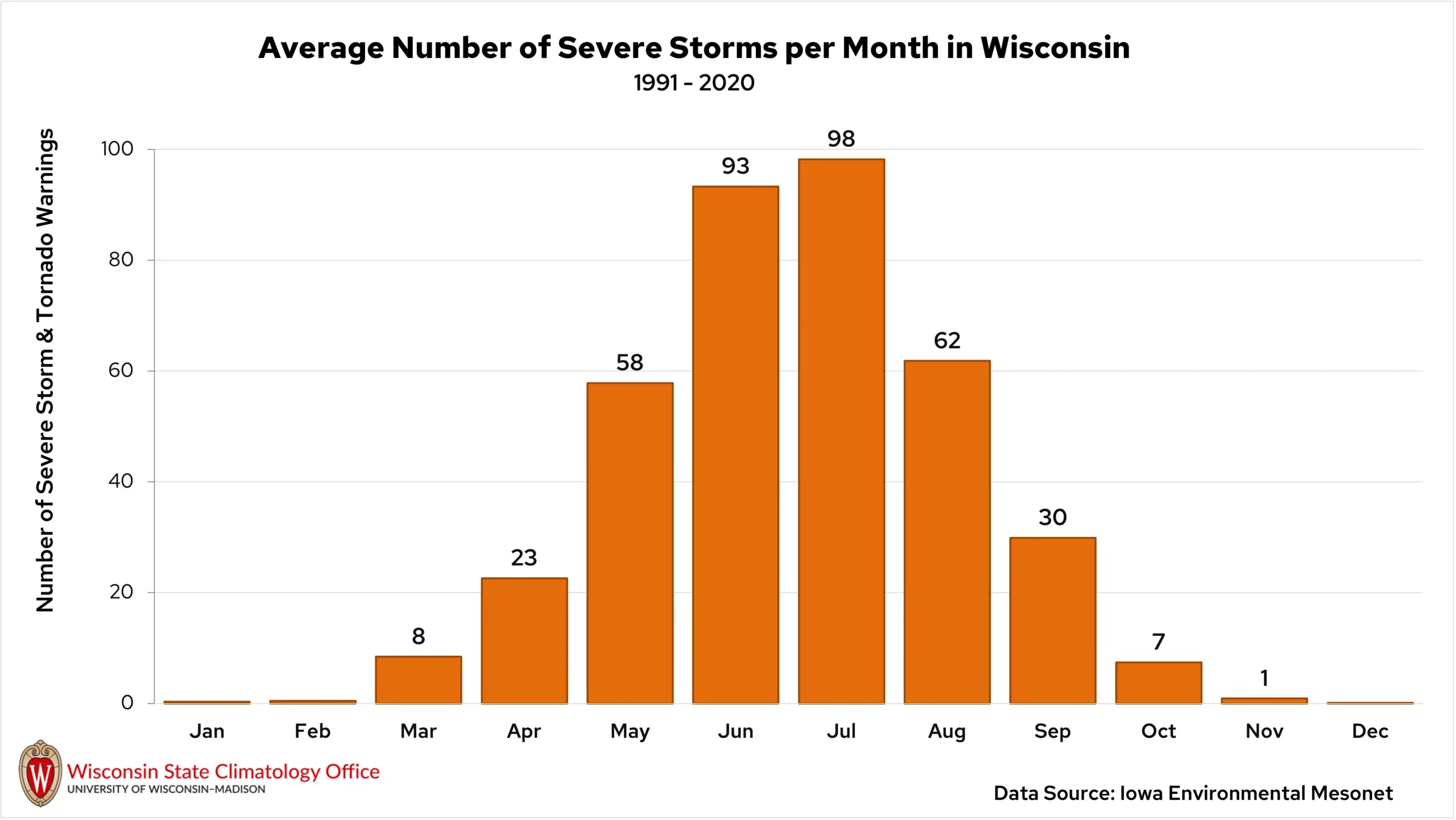
Wisconsin’s severe weather season typically begins in late spring and peaks in June and July. However, severe storms can develop at any time, so it’s important to always be prepared.
Common severe weather threats in Wisconsin include tornadoes, straight-line winds, and large hail.
Weather Warnings
Alerts are issued by the National Weather Service ahead of and during severe weather events to keep the public safe.
When meteorologists expect severe weather to occur in the coming hours, a “watch” will be issued. Watches often cover multiple counties where meteorologists expect severe weather to take place. When severe weather has developed, a “warning” will be issued. Warnings are issued only for the areas being impacted and often last for less than an hour.
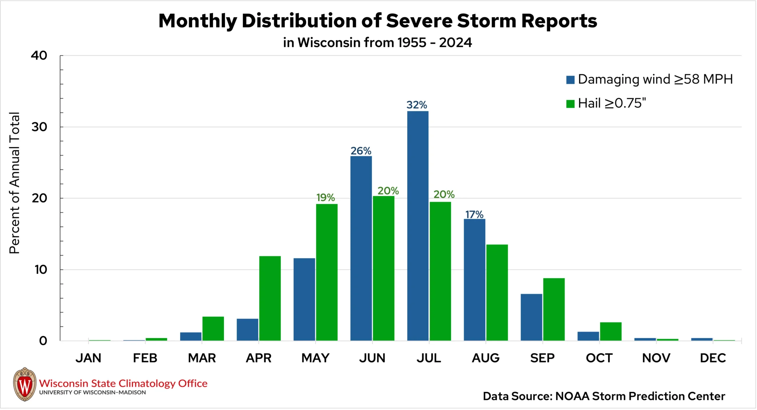
Severe thunderstorm warnings are issued when a storm produces winds of at least 58 miles per hour or hail larger than an inch in diameter, about the size of a quarter. Tornado warnings are issued when National Weather Service meteorologists see signs of rotation in a storm on radar or receive reports of a tornado happening from local storm spotters.
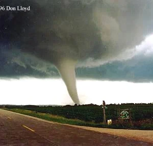
Tornadoes
On average, 23 tornadoes touch down in Wisconsin every year. Many of those occur in June, followed by July as the second most active month. The most tornadoes recorded in one year in Wisconsin was 2005, when 62 tornadoes occurred.
The strength of tornadoes is ranked from zero to five on the Enhanced Fujita (EF) scale, which uses storm damage to estimate the wind speeds that the tornado produced. Since 1955, about 80 percent of Wisconsin’s tornadoes have been ranked as a zero or one on the EF scale.
Some of the strongest tornadoes in Wisconsin’s history were the Barneveld tornado on June 8, 1984, and the Oakfield tornado on July 18, 1996. The deadliest was the New Richmond tornado on June 12, 1899, that took the lives of 117 people. Between 1955 and 2025, 85 deaths have been attributed to tornadoes in the state.
In 2024, the state’s first February tornadoes on record occurred in southern Wisconsin. With the addition of those February twisters, a tornado has been recorded in every month of the year in the Badger State.
Damaging Winds
Powerful winds are the most common type of severe weather in Wisconsin, with nearly 200 reports of wind damage in the state every year. Straight-line winds in thunderstorms can peak at 75 to 100 mph, which is equal to the strength of a Category 1 hurricane!
Reports of damaging winds are most common in June and July, with over 50 percent of the state’s annual reports occurring during the two months. The majority of Wisconsin’s damaging wind speeds are between 60 and 70 miles per hour, with just over 20 percent exceeding 80 miles per hour.
A long-lived, fast-moving line of storms called a derecho can cause widespread straight-line wind damage. In May 1998, a strong derecho swept through south-central Wisconsin — a 128 mph wind gust was reported in southern Dodge County near Watertown. That storm created $60 million in property losses and $1.82 million in crop damage.
Hail
Most hailstones in Wisconsin measure between one and two inches in diameter, but even the smaller stones can pack a big punch. In 2024, hail caused nearly two million dollars in damage in Wisconsin.
Hail-producing thunderstorms develop most frequently between May and July. Hail is often the dominant threat from spring and fall thunderstorms due to the favorably cooler air in those seasons that aids in hailstone formation. This is also why hail is more common in northern Wisconsin compared to the southern regions.
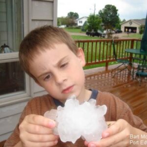
The largest hailstone recorded in the state fell in Wausau in May of 1921, measuring 5.7 inches — about the size of a DVD! The second-largest hailstone measured 5.5 inches in Port Edwards. That hailstorm in June of 2007 created over $40 million in damage in Wood County.
Shift in Severe Weather Season
Following events like the February tornadoes in 2024 and the state’s largest October tornado outbreak in 2022, many Wisconsinites have felt that the state’s severe weather season has been changing.
Comparing the distribution of severe weather reports by month from 1955 to 1989 and that of 1990 to 2024, a shift is evident. In earlier decades, the severe weather season had a clear peak in July. In more recent decades, that peak has flattened, spreading severe weather activity more evenly through May, June, and July. Storm activity has also increased in March, April, and September.
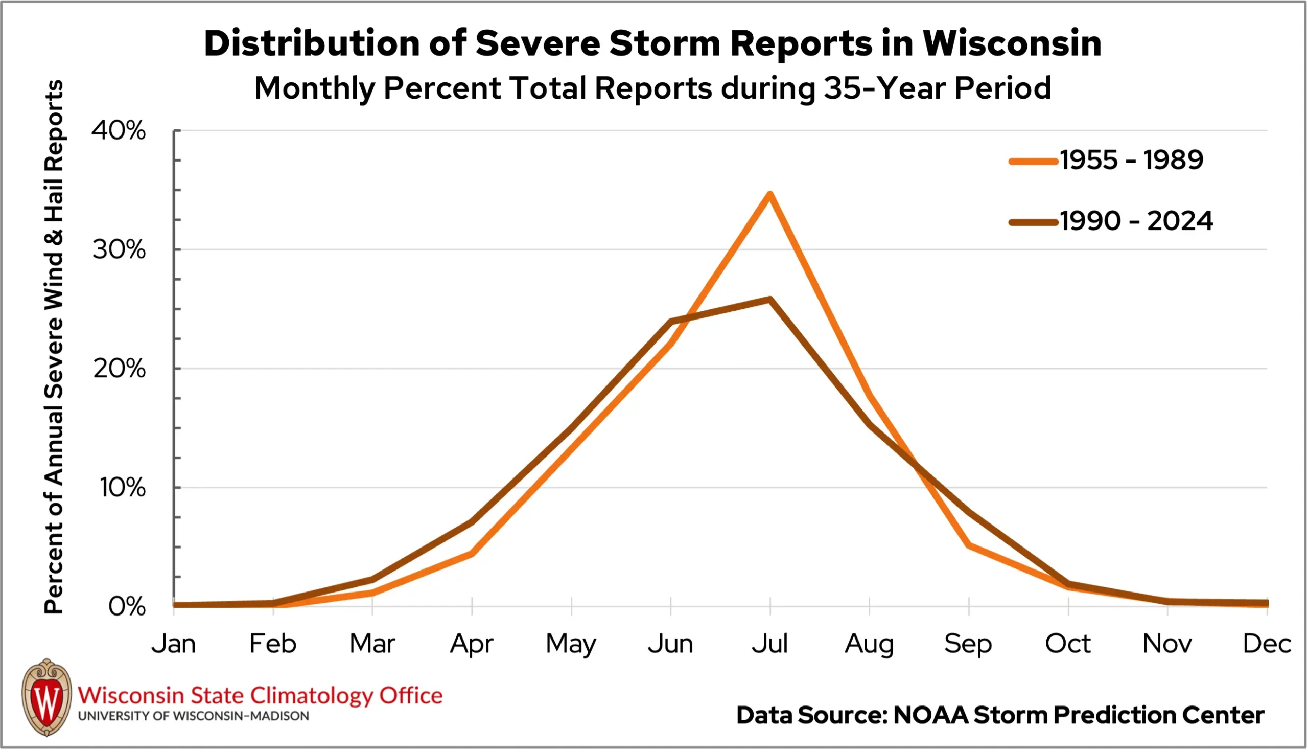
As Wisconsin’s seasons have grown warmer, our spring and fall weather has become more favorable for thunderstorm development. And Wisconsin isn’t alone in this — an increasing trend in thunderstorm potential has been observed across much of the central and eastern United States in recent decades.
This shift emphasizes the importance of staying prepared for and informed about severe weather, no matter the season.
This is a product of the Wisconsin State Climatology Office. For questions and comments, please contact us by email (stclim@aos.wisc.edu) or phone (608-263-2374).