El Niño is part of a climate pattern driven by changes in Pacific Ocean water temperatures near the equator. When those waters become warmer than usual, an El Niño has developed.
Though seemingly distant, these warm ocean temperatures can shift global atmospheric circulations. Wisconsin primarily feels El Niño’s impacts during winter, as the pattern often brings milder-than-average temperatures to the region.
Learn more about El Niño and its impacts on Wisconsin.
Below, we’ll discuss what some of the recent winter (December-February) El Niño events looked like in Wisconsin. All data are compared to the state’s 1991-2020 climate normals.
2023-2024: Moderate El Niño
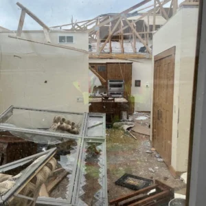
Known as Wisconsin’s “Lost Winter”, this season was the state’s warmest winter since 1895 and featured significant snow deficits.
The lack of snow was especially pronounced in the northern and central regions, with some areas receiving up to 60 fewer inches of snow than a normal winter. Local businesses struggled as winter tourism was nearly nonexistent, and those in the driest areas became eligible for federal disaster relief.
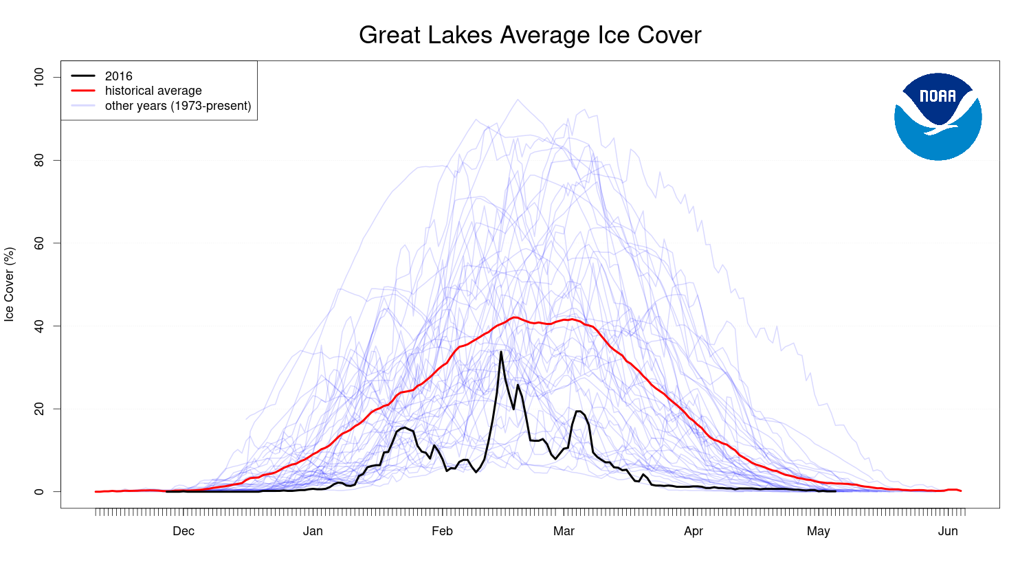
Amidst the warmth, ice was slow to form on the region’s lakes. Madison’s local lakes only froze for about six weeks, and the Great Lakes saw historic low ice cover.
This season also delivered the state’s warmest winter temperature on record and the first known February tornadoes.
2018-2019: Weak El Niño
This winter season’s cool temperatures helped produce the Badger State’s snowiest winter on record. Some parts of the west-central region doubled or even tripled their average winter snowfall.
The season got off to a slow start in December, but January and February were jam-packed with winter “fun”.
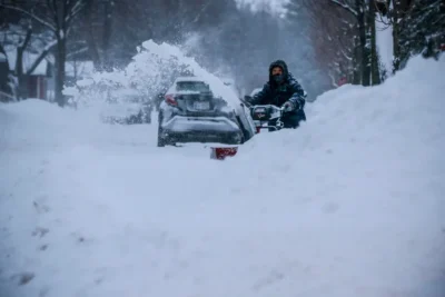
Late January featured a historic outbreak of Arctic air, dropping temperatures to 30 to 40 degrees below zero while wind chills reached 50 below.
Two major snowstorms hit central Wisconsin in February. The first storm went down as Wausau’s largest February storm, while the second storm created blizzard conditions.
The Double Feature of 2014 through 2016: Weak to Very Strong El Niño
This unusual El Niño event persisted for more than 12 months, starting as a relatively weak event during winter 2014 to 2015, but strengthening to a very strong event by winter 2015 to 2016.
Wisconsin’s temperatures ran cool during winter 2014 to 2015, with a statewide average nearly three degrees below the 30-year normal. However, the cold wasn’t accompanied by snowfall. Much of the state was 10 to 20 inches shy of average winter snowfall, with even higher deficits across the northern counties.
The following winter was a completely different story. The season was Wisconsin’s fourth warmest and fourth wettest — though much of that precipitation fell as rain rather than snow. December 2015 was by far the state’s wettest on record despite many areas seeing half of their normal snowfall.
Lake ice was slow to form, and once it did, it didn’t last long. Ice cover on the Great Lakes fluctuated through the winter, but remained consistently below average. In Madison, Lake Mendota was frozen for just 62 days, tying for the seventh-shortest period on record.
2009-2010: Strong El Niño
The 2009-2010 winter was slightly cooler than usual in Wisconsin and came with extra snowfall.
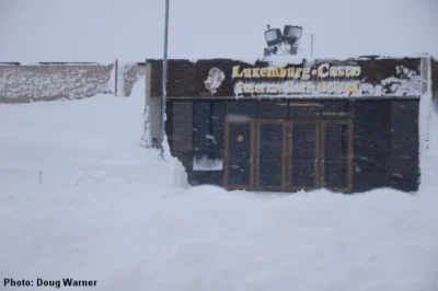
The season came out swinging with a huge snowstorm in early December that dropped 10 to 20 inches of snow across central Wisconsin and created blizzard conditions in the northeast. Two additional large snowstorms in January and February accounted for much of the state’s seasonal snowfall.
The season’s cold was unequally distributed. During both January and February, northeastern counties experienced warmer-than-average temperatures, while western and southern regions were abnormally cold.
2006-2007: Weak El Niño
Wisconsin experienced mild temperatures and slightly drier conditions during the weak El Niño event during winter 2006-2007. These impacts were especially pronounced in central and northern Wisconsin, where some locations were two to three degrees warmer than average and more than a foot shy of normal snowfall.
Residents in the southern counties felt a more typical Wisconsin winter. Average temperatures were near normal, and many places received up to a foot more snowfall than usual. Part of the surplus could be attributed to a massive blizzard that hit the southeast region on the first day of December.
2002-2003: Moderate El Niño
This season remains Wisconsin’s second-driest winter on record since 1895. The state averaged only 17 inches of snow, less than half of a normal winter’s snowfall. Dodge, Washington, and Ozaukee counties were especially brown, receiving just five to 10 inches of snow for the entire season. The lack of snow allowed frost to penetrate deep into the ground, reaching as far down as 5 feet in some areas. The deep freeze resulted in frozen water lines and damaged tree root systems.
Though the season started mild in December, both January and February were colder than normal. February was particularly frigid, with nearly two weeks of sub-zero temperatures in the north.
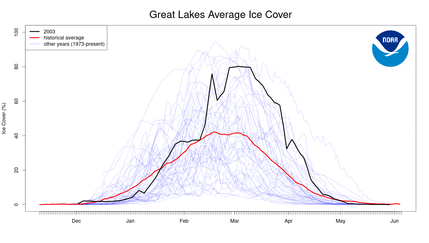
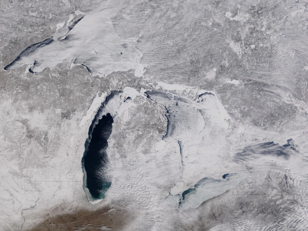
Ice cover on the Great Lakes was above the historical average this season, with four of the five lakes nearing 100 percent ice coverage.
1997-1998: Very Strong El Niño
At the time, the winter of 1997-1998 was the Badger State’s warmest season on record by far, surpassing the previous record by about three degrees. The season’s record has since been surpassed, but it still ranks impressively as third-warmest. Spurts of unseasonable warmth brought temperatures near 50 degrees in the north, and near 60 degrees in the south during January and February.
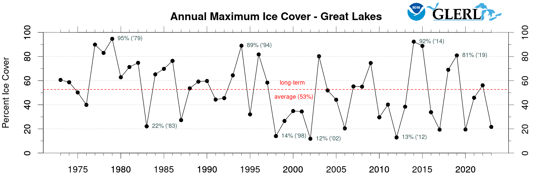
As expected, the warmth delayed ice formation on local lakes. In Madison, Lake Monona was frozen for just 49 days — the shortest period on record at the time. At their maximum, just 14 percent of the Great Lakes were frozen, the third-lowest maximum since 1973.
The state also lacked snow, though conditions varied through the season. December was extremely dry, but in January, much of the state received double the normal amount of monthly snowfall. Part of this surplus was from a potent storm that dumped up to a foot of snow on eastern Wisconsin, before turning into a devastating ice storm in the northeast.
These quick recaps go to show that El Niño events can have varying impacts on Wisconsin’s winters, though mild temperatures are the most common side effect. Furthermore, the strength of the El Niño event doesn’t always correlate with the intensity of the impacts.
This is a product of the Wisconsin State Climatology Office. For questions and comments, please contact us by email (stclim@aos.wisc.edu) or by phone (608-263-2374).